
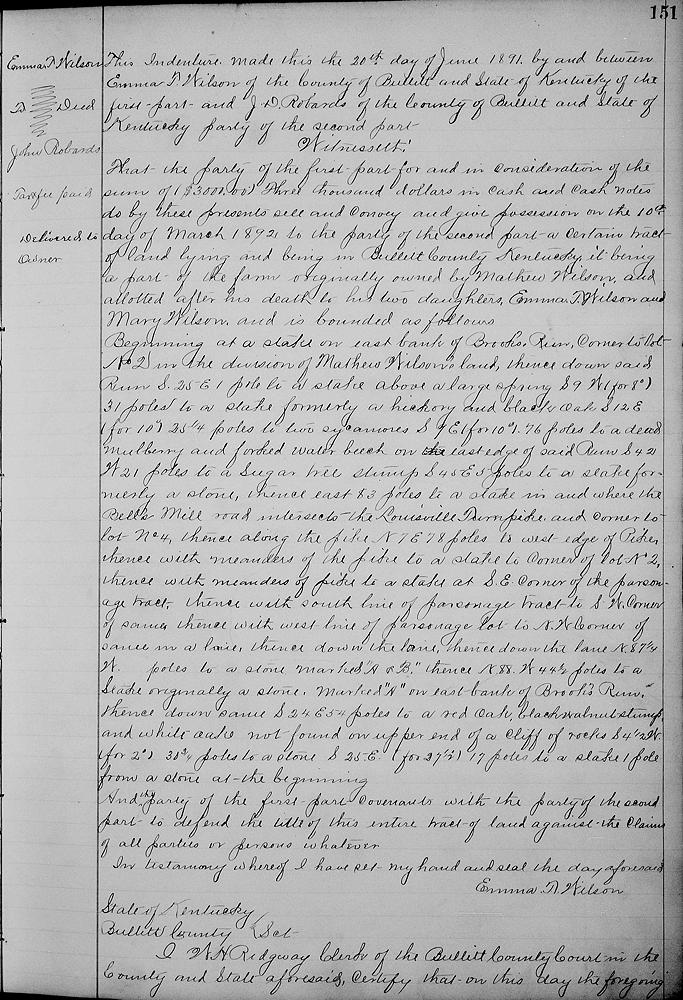
On 20 Jun 1891, Emma T. Wilson sold to J. D. Robards the better part of the tract of land allotted to her in the division of her father's land, and that allotted to her sister, Mary W. Saunders who had deed her part to Emma earlier. It excluded the land deeded to the Presbyterian Church for a sanctuary and a parsonage.
Bullitt County Deed Book 29, Page 151-152
This indenture made this 20th day of June 1891 by and between Emma T. Wilson of the county of Bullitt and state of Kentucky of the first part and J. D. Robards, of the county of Bullitt and state of Kentucky, party of the second part. Witnesseth that the party of the first part for and in consideration of the sum of $3000 in cash and cash notes do by these presents sell and convey and give possession on the 10th day of March 1892 to the party of the second part, a certain tract of land lying and being in Bullitt County, Kentucky, it being a part of the farm originally owned by Matthew Wilson, and allotted after his death to his two daughters Emma T. Wilson and Mary Wilson, and is bounded as follows.
Beginning at a stake on east bank of Brooks Run, corner to Lot No. 2 in the division of Mathew Wilson's land, thence down said run S 25° E 1 pole to a stake above a large spring, S 9° W (for 8°) 31 poles to a stake, formerly a hickory and black oak, S 12° E (for 10°) 25 1/4 poles to two sycamores, S 9° E (for 10°) 76 poles to a dead mulberry and forked water beech on the east edge of said run, S 42° W 21 poles to a sugar tree stump, S 45° E 5 poles to a stake, formerly a stone, thence East 83 poles to a stake in and where the Bell's Mill Road intersects the Louisville Turnpike, and corner to Lot No. 4, thence along the pike N 7° E 78 poles to west edge of pike, thence with meanders of the pike to a stake to corner of Lot No. 2, thence with meanders of pike to a stake at southeast corner of the parsonage tract, thence with south line of parsonage tract to southwest corner of same, thence with west line of parsonage lot to northwest corner of same in a lane, thence down the lane N 87 1/4° W __ poles to a stone marked "A & B," thence N 88° W 44 1/2 poles to a stake, originally a stone marked "A" on east bank of Brooks Run, thence down same S 24° E 54 poles to a red oak, black walnut stump and white oak not found on upper end of a cliff of rocks, S 4 1/2° W (for 2°) 30 3/4 poles to a stone, S 25° E (for 27 1/2°) 17 poles to a stake 1 pole from a stone at the beginning.
And the party of the first part covenants with the party of the second part to defend the title of this entire tract of land against the claims of all parties or persons whatever. In testimony whereof I have set my hand and seal the day aforesaid.
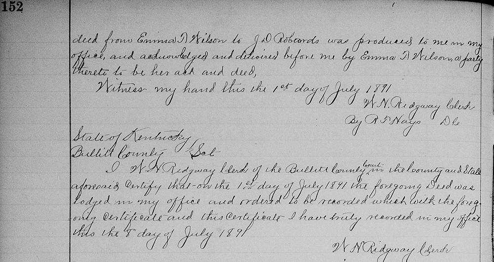
[Signed by Emma T. Wilson and recorded in the Bullitt Clerk's office on 1 Jul 1891.]
If you, the reader, have an interest in any particular part of our county history, and wish to contribute to this effort, use the form on our Contact Us page to send us your comments about this, or any Bullitt County History page. We welcome your comments and suggestions. If you feel that we have misspoken at any point, please feel free to point this out to us.
The Bullitt County History Museum, a service of the Bullitt County Genealogical Society, is located in the county courthouse at 300 South Buckman Street (Highway 61) in Shepherdsville, Kentucky. The museum, along with its research room, is open 10 a.m. to 4 p.m. Monday through Friday. Saturday appointments are available by calling 502-921-0161 during our regular weekday hours. Admission is free. The museum, as part of the Bullitt County Genealogical Society, is a 501(c)3 tax exempt organization and is classified as a 509(a)2 public charity. Contributions and bequests are deductible under section 2055, 2106, or 2522 of the Internal Revenue Code. Page last modified: 12 Sep 2024 . Page URL: bullittcountyhistory.org/bchistory/emmawilson-robards.html