
Jacob Froman came by this tract in a bit of a round-about way, as we shall see.
On November 3, 1779, a preemption warrant (#168) was issued to John Rutan by the Commissioners of Monongalia, Yohogania & Ohio Counties of Virginia for 600 acres on the watercourse of the Monongalia River in what is now western Pennsylvania and northern West Virginia. This territory was then claimed by both Pennsylvania and Virginia, and both states established counties over the same land. [See details here.] Rutan paid the sum of 240 pounds for this warrant which gave him the right to stack his claim to 600 acres somewhere in that area.
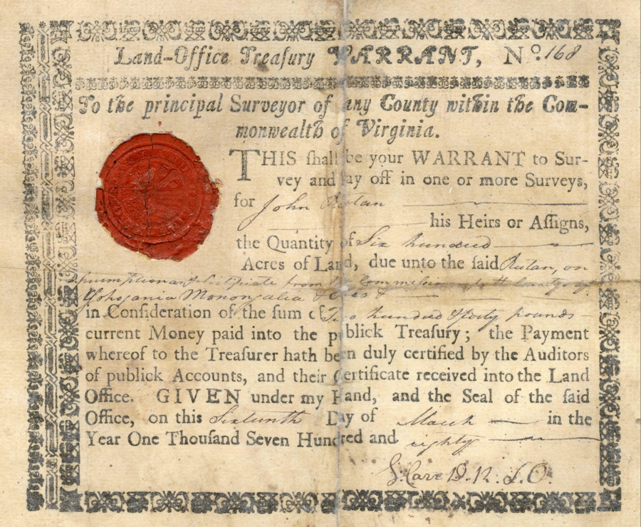
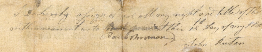
However, with the uncertainty regarding Virginia's claim to this land, all of what was then Kentucky County was opened up to these warrants. Rutan signed over this warrant to Paul Froman on 15 May 1780, likely in a trade of some kind.
Paul Froman held onto it for sixteen years until he found he could use it to claim a tract of land at the juncture of Salt and Rolling Fork rivers. He had James Cox survey the land on 1 Dec 1796. Note that the drawing of the tract on this survey has the eastern side of it at the top rather than the traditional northern side.
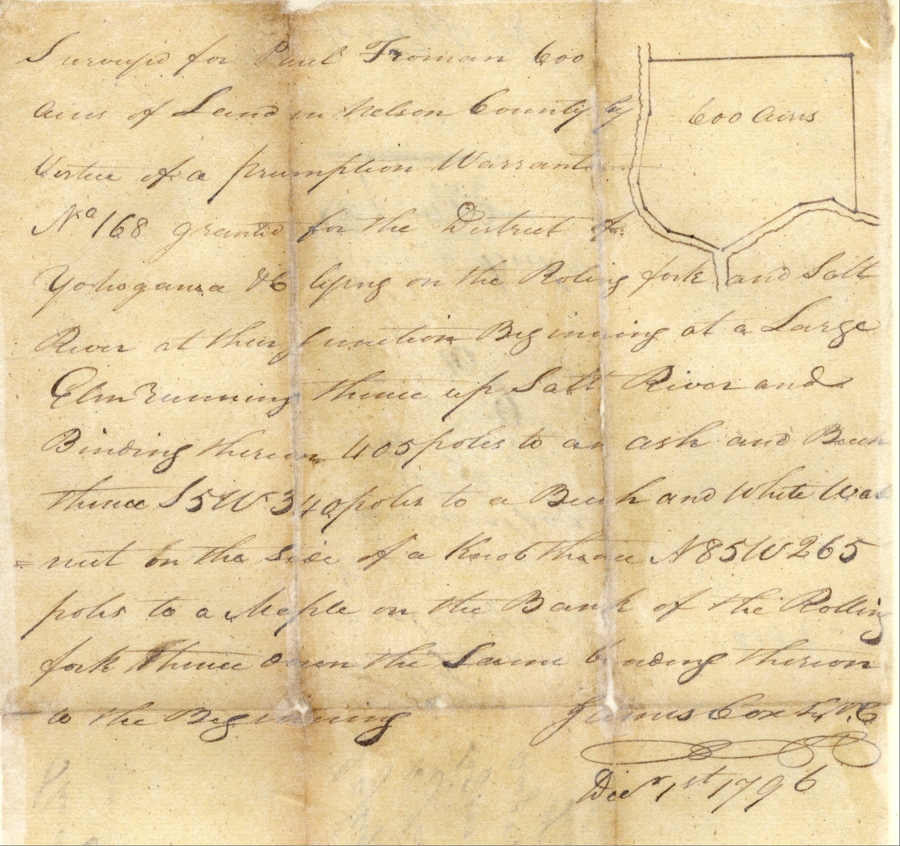
"Surveyed for Paul Froman 600 acres of Land in Nelson County by virtue of a preemption warrant No. 168 granted for the District of Yohogania & lying on the Rolling Fork and Salt River at their junction. Beginning at a large elm, running thence up Salt River and binding thereon 405 poles to an ash and beech, thence S 5 W 340 poles to a beech and white walnut on the side of a knob, thence N 85 W 265 poles to a maple on the bank of the Rolling Fork, thence over the same binding thereon to the beginning. (signed) James Cox, Dec 1st 1796."
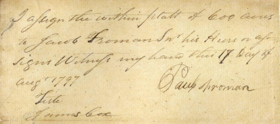
Then Paul Froman assigned it over to his brother, Jacob Froman on 17 Aug 1797.
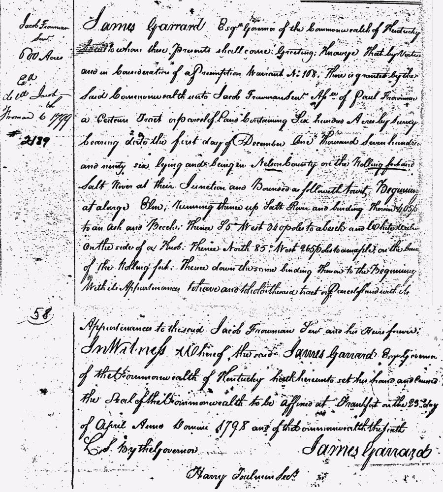
Finally, on 23 Apr 1798 Jacob Froman received a formal deed to his 600 acres, as shown below. Note that the land continued to be identified as being in Nelson County even though Bullitt County had been established the previous year. This was because the original survey was made while the land was still a part of Nelson County.
By 1815 Jacob Froman was living in Woodford County, and on 5 Jun 1815 he sold the six hundred acres to his son, Abraham Froman. This deed is transcribed below.
Bullitt County Deed Book C, pages 225-6
Jacob Froman to Abraham Froman
600 Acres
This indenture made this 5th day of June 1815 by and between Jacob Froman of the County of Woodford and State of Kentucky of the one part, Abraham Froman of the County of Harding and State aforesaid of the other part, witnesseth that the said Jacob for his part hath bargained, sold, setover, and delivered to the said Abraham a certain tract or parcel of land in the County of Bullitt at the mouth of the Rolling Fork, containing six hundred acres of land for one dollar per acre, as followeth, towit, beginning at a large elm at the mouth of the Rolling Fork at the upper side, running thence up Salt River as it meanders four hundred and five poles to an ash and beech, thence S 5° W 340 poles to a beech and white walnut on the side of the knob, thence N 85° W 265 poles to a maple on the bank of the Rolling Fork, thence down the same binding on the same to the beginning; containing six hundred acres of land for which is to be paid by the said Abraham to the said Jacob the sum of one dollar per acre, and on which the said Jacob hath received of the said Abraham the sum of four hundred and fifty dollars, the balance of fifty out of the hundred and fifty is to remain in the hands of the said Abraham without interest for two years till it can be settled with Hite whether his claim should be a better claim or not and if that or anymore should be lost in that place the said Jacob shall repay with interest one dollar per acre for every acre so lost for which lands and tenaments the said Jacob Froman, his heirs or assigns, shall and will warrant and forever defend to the said Abraham Froman, his heirs, executors and administrators against the claim or claiments of all other persons claiming by, from, or under him. In testimony I have hereunto set my hand and bind my seal the day and date first written. In the presence of Jacob Froman.
Bullitt County Sct.
I James Halbert, clerk of the county court in and for the county aforesaid do certify that on the date hereof, the written indenture from Jacob Froman to Abraham Forman was produced to me in my office by said Jacob and acknowledged to be his act and deed for the purpose therein mentioned and that I have truly recorded the same together with this certificate in my said office, given under my hand this 5th day of June 1815. (signed) James Halbert, Clerk of Bullitt County Court.
This 600 acre tract would become important to Bullitt County history as it included the land that would become the community of Pitts Point. The map below shows an approximation of the location of the 600 acres and where Pitts Point lay at the junction of the two rivers.
If you, the reader, have an interest in any particular part of our county history, and wish to contribute to this effort, use the form on our Contact Us page to send us your comments about this, or any Bullitt County History page. We welcome your comments and suggestions. If you feel that we have misspoken at any point, please feel free to point this out to us.
The Bullitt County History Museum, a service of the Bullitt County Genealogical Society, is located in the county courthouse at 300 South Buckman Street (Highway 61) in Shepherdsville, Kentucky. The museum, along with its research room, is open 10 a.m. to 4 p.m. Monday through Friday. Saturday appointments are available by calling 502-921-0161 during our regular weekday hours. Admission is free. The museum, as part of the Bullitt County Genealogical Society, is a 501(c)3 tax exempt organization and is classified as a 509(a)2 public charity. Contributions and bequests are deductible under section 2055, 2106, or 2522 of the Internal Revenue Code. Page last modified: 12 Sep 2024 . Page URL: bullittcountyhistory.org/bchistory/froman600.html