
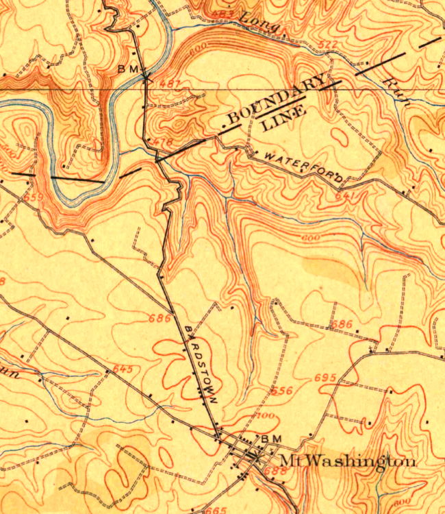
The following images are taken from a USGS topographic map drawn in 1907. The first one shows the route of the Louisville to Mt. Washington road. The boundary line is the border between Jefferson and Bullitt Counties. The stream the road crosses before entering Bullitt County is Floyd's Fork.
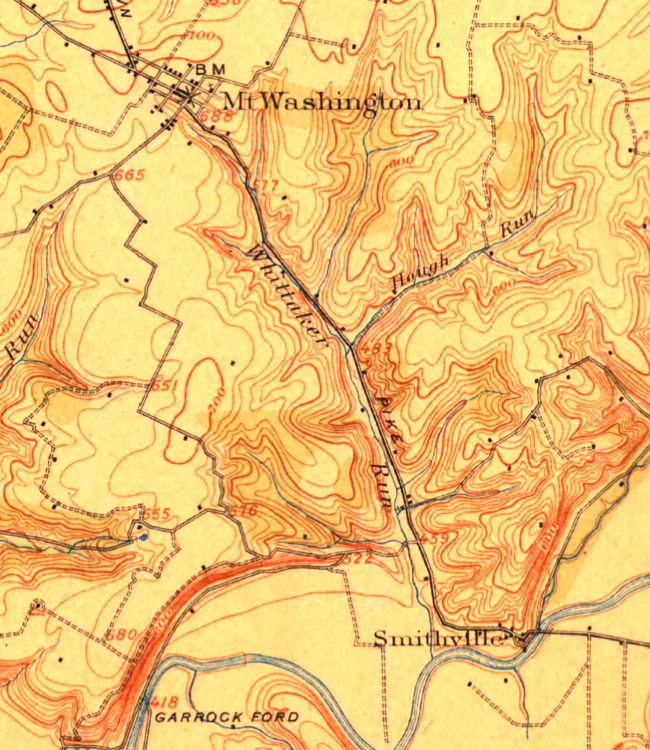
The second image shows the road from Mt. Washington to Smithville at the Bullitt-Nelson Counties line.
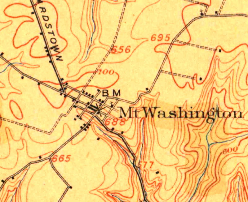
The final image is a close-up that shows the streets of Mt. Washington in 1907.
If you, the reader, have an interest in any particular part of our county history, and wish to contribute to this effort, use the form on our Contact Us page to send us your comments about this, or any Bullitt County History page. We welcome your comments and suggestions. If you feel that we have misspoken at any point, please feel free to point this out to us.
The Bullitt County History Museum, a service of the Bullitt County Genealogical Society, is located in the county courthouse at 300 South Buckman Street (Highway 61) in Shepherdsville, Kentucky. The museum, along with its research room, is open 10 a.m. to 4 p.m. Monday through Friday. Saturday appointments are available by calling 502-921-0161 during our regular weekday hours. Admission is free. The museum, as part of the Bullitt County Genealogical Society, is a 501(c)3 tax exempt organization and is classified as a 509(a)2 public charity. Contributions and bequests are deductible under section 2055, 2106, or 2522 of the Internal Revenue Code. Page last modified: 12 Sep 2024 . Page URL: bullittcountyhistory.org/bchistory/loutobard.html